Osama bin Laden’s dead. But before we offed him, he was camped out in a Pakistani mansion—and in typical internet fashion, it's already pinpointed on Google. The mapper's anonymous, but they reveal strange things—police station neighbors?
Osama bin Laden’s dead. But before we offed him, he was camped out in a Pakistani mansion—and in typical internet fashion, it's already pinpointed on Google. The mapper's anonymous, but they reveal strange things—police station neighbors?

Which do you think emits more CO2: four guys running one mile, or four guys driving one mile in a hybrid car? If you’ve read the headline, then you already know the answer is quite surprising.
See original article:
Driving a hybrid car pollutes less than human beings running
Steve Jobs is arguably one of the most successful CEOs ever.

Using aerial photos, image-processing software created this 3-D model of San Francisco, accurate to 15 centimeters. Credit: C3 Technologies
Collecting and processing rapidly is C3 Technologies’ core advantage. Since our spin out from the aviation and defense company, Saab AB, C3’s expertise in image processing and systems integration of airborne and terrestrial data capture systems ensures that our products are calculated with extremely high precision.
C3’s Technologies’ process is fully automated, producing large amounts of 3D data with minimal manual work. We are expanding our terrestrial collection capabilities to pedestrian and waterway locations and offer integration tools for those interested in interior places.
C3 is building a store of eye-popping 3-D models of major cities to license to others for mapping and other applications. The first customer to go public with an application is Nokia, which used the models for 20 U.S. and European cities for an upgraded version of its Ovi online and mobile mapping service released last week. “It’s the start of the flying season in North America, and we’re going to be very active this year,” says Paul Smith, C3’s chief strategy officer.
C3’s models are generated with little human intervention. First, a plane equipped with a custom-designed package of professional-grade digital single-lens reflex cameras takes aerial photos. Four cameras look out along the main compass points, at oblique angles to the ground, to image buildings from the side as well as above. Additional cameras (the exact number is secret) capture overlapping images from their own carefully determined angles, producing a final set that contains all the information needed for a full 3-D rendering of a city’s buildings. Machine-vision software developed by C3 compares pairs of overlapping images to gauge depth, just as our brains use stereo vision, to produce a richly detailed 3-D model.
“Unlike Google or Bing, all of our maps are 360° explorable,” says Smith, “and everything, every building, every tree, every landmark, from the city center to the suburbs, is captured in 3-D—not just a few select buildings.”
“The advantage of C3’s image-only scheme is that aerial LIDAR is significantly more expensive than photography, because you need powerful laser scanners,” says Zakhor. “In theory, you can cover more area for the same cost.” However, the LIDAR approach still dominates because it is more accurate, she says. “Using photos alone, you always need to manually correct errors that it makes,” says Zakhor. “The 64-million-dollar question is how much manual correction C3 needs to do.”
Smith says that C3’s technique is about “98 percent” automated, in terms of the time it takes to produce a model from a set of photos. “Our computer vision software is good enough that there is only some minor cleanup,” he says. “When your goal is to map the entire world, automation is essential to getting this done quickly and with less cost.” He claims that C3 can generate richer models than its competitors, faster.
Smith says that augmented-reality apps allowing a phone or tablet to blend the virtual and real worlds are another potential use. “We can help pin down real-world imagery very accurately to solve the positioning problem,” he says. However, the accuracy of cell phones’ positioning systems will first have to catch up with that of C3’s maps. Cell phones using GPS can typically locate themselves to within tens of meters, not tens of centimeters.
GPS accuracy can be enhanced to tens of centimeters
Carrier-Phase Enhancement (CPGPS) – CPGPS makes use of the 1.575 GHz L1 carrier wave, which plays the role of a clock signal for helps in resolving ambiguities. Usually ambiguities are caused due to frequent changes in C/A PRN, and location of the pulse transition, which is represented by the logic 0-1 and 1-0 transition.
How Does CPGPS Help in Improving GPS Accuracy Levels?
Basically, the root of the problem is that the C/A signal isn’t instantaneous; there is a considerable amount of tag lag between the instants when the signal reaches digital logic value ‘1’ from ‘0’, and vice versa. The end result is inconsistent satellite-receiver sequence matching.
The 1.575 GHz L1 carrier wave helps in defining a precise transition point (due to very small period of 1/1000 that of C/A bit width). As a result, CPGPS can help in achieving up to 1% ambiguity levels, which amounts to about 3mm, while the regular ambiguity levels in GPS operation are in the range of 2 to 3 meters.
To improve the GPS accuracy furthermore, DGPS (Differential GPS) can be clubbed with CPGPS (Carrier-Phase Enhancement) to realize high accuracy levels of about 20-30 centimeters.
Differential GPS, often referred to as DGPS in short, allows you to improve the accuracy of GPS readings up to an excellent level of about one meter to three meters, which is a lot better than the regular reading levels of 4-20 meters.
How Differential GPS Works
It makes use of a network of stationary GPS receivers, and it is quite similar to civilian system run by the US Coast Guard on most of the waterways, and marine longwave radio transmission.
In DGPS, the difference between the position of the reference object estimated by the satellite signals, and the actual pre-defined position is calculated, which is termed as error factor. Now, this error component is used as a carrier for transmitting FM signals, used by the local GPS received. Finally, necessary corrections are applied to achieve higher accuracy levels
If you liked this article, please give it a quick review on ycombinator or StumbleUpon. Thanks


View original post here:
3-D Maps accurate to 15 centimeters
There aren’t many spider videos we’d say you absolutely had to watch all the way through, but this time you really should.
This video has been making its way around the web for some time now, but that doesn’t make it any less special to us. The best part comes at the end, but we really suggest not skipping ahead to the good part.
It’s really worth the wait.
See the original post:
Spider Attack Caught On Tape, Not What You'd Expect (VIDEO)

Tiny pupfish found in the shallow, salty lakes of Mexico and the Caribbean are experiencing some of the fastest evolution ever seen, changing their features 130 times faster than their fishy relatives. And we don’t have the foggiest idea why. More

![]()
Netflix, the DVD-by-mail and streaming movie giant, now has as many subscribers as Comcast, and in the evenings accounts for more than 40 percent of US bandwidth usage by some measurements.
Those astounding numbers are leading some to wonder whether Netflix is reducing the amount of peer-to-peer file sharing, once the easiest way to find movies to watch.

Read the comments on this post
View the original here:
Is Netflix reducing illicit file sharing? Depends on which stats you believe
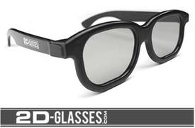
I have no idea if these 2D glasses — which purport to convert 3D movies to 2D — work, but they’d be a godsend for me if they did. I get wicked headaches from 3D movies, and all the blockbusters in town are showing 3D-only half the time. We’ve switched date-night to art-house movies and live theater, which are great, but sometimes my wife really, really wants to see robots blowing stuff up and I hate to be a stick in the mud.
2D glasses are designed to convert 3D graphics into 2D through a single polarized channel. This product helps eliminate headaches, nausea and motion sickness. Wear this where RealD 3D technology is used.
(via Red Ferret)

See the original post:
Glasses convert 3D movies to 2D